


See the event. Know who could be affected.
Weather and security alerts for people, sites, and journeys.
Bring weather warnings and security events together with live locations, monitored sites, and planned travel. Spend less time comparing separate sources, identify potential exposure sooner, and give the right teams a clear next step.
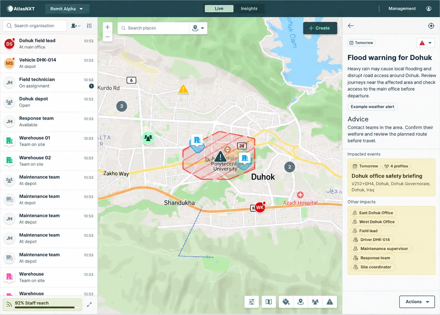
From event to everyone accounted for, and lessons learned.
Prepare before conditions change. Then connect the warning, the people at risk, and the response in one platform.
01 / DETECT
See what has changed
Bring weather and security events into the operating picture. Revisit the checks and plans that matter.
02 / LOCATE
Know who may be exposed
Compare the affected area with live locations, satellite positions, monitored places, and planned visits.
03 / CONTACT
Find out who needs help
Send instructions and request welfare updates from the affected team. Review replies, and follow up.
04 / LEARN
Coordinate and keep the evidence
Assign follow-up, record decisions, and review the response. Use the findings to improve the next assessment.
Build the right package around your people and operations. Book a demo
Put risk information to work.
Bring changing events into the risk, travel, and continuity processes your organisation already follows. Give teams a clearer basis for deciding who needs support and which activities need attention.
Duty of care
Identify who may need advice, contact, or assistance.
Travel risk management
ISO 31030
Assess changing conditions around planned journeys.
Risk management
ISO 31000
Bring event information into assessment and response decisions.
Business continuity
ISO 22301
Review disruption around sites and critical activities.


See the exposure. Decide the next move.
Give operators one view of external events and the people, places, and plans that could be affected. Move from reviewing a warning to deciding who needs a message, a welfare check, or a change of plan.
Understand the area at risk
See weather warnings and affected areas on the Control Centre map. Review conditions around teams and monitored sites before deciding where to focus your response.
Assess the report before you act
Review security reports by location, category, source, and time. Filter by event type, severity, and publisher to focus on developments relevant to your operation.
Find the people and places that need attention
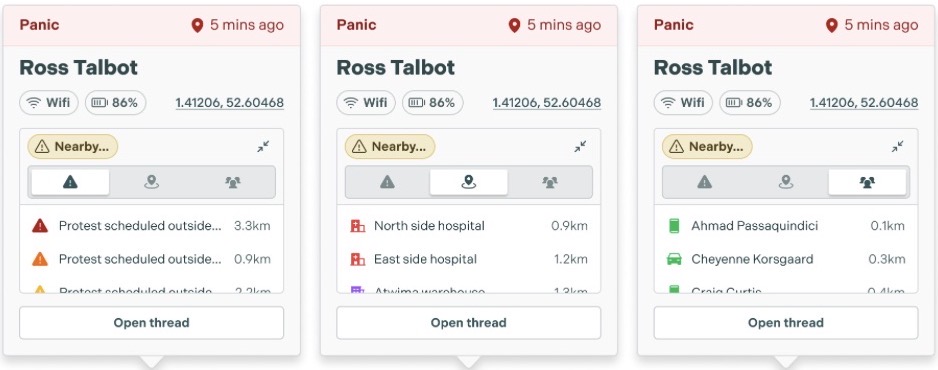
Compare the event with staff locations, satellite positions, monitored sites, and scheduled activity. Focus the response on the people and places that may be exposed, then contact them with guidance or a welfare check.
Act before the journey starts
Connect Microsoft and Google calendars to review upcoming meetings, site visits, and trips against relevant events. Contact travellers, provide advice, or review a visit before your people arrive.
Your organisation’s IT administrator connects Microsoft or Google calendars so scheduled events can inform exposure reviews. Review the connection’s permissions and your organisation’s privacy requirements with your IT team during setup.
How we handle personal data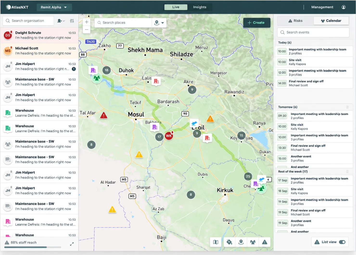
Where the intelligence comes from
Global Alerts brings together weather information, external news, and connected security feeds. Filter reports by publisher, event type, and severity, then compare related source reports to build a clearer picture.
Your operators add the local context: what the event could mean for your people, which activities need attention, and what response to coordinate.
Explore Security InsightsKeep contact when mobile coverage ends
A remote team still needs a way to check in. Compatible satellite devices bring position updates, two-way messaging, and panic alerts into AtlasNXT when mobile networks are unavailable.
Review the event in the control centre, locate the team, and use satellite communication to pass instructions and receive updates from remote sites, offshore operations, and journeys beyond GSM coverage.
Explore satellite communicationFor teams whose work takes them into changing conditions
Manufacturing and Industrial
For infrastructure and construction projects: review exposure around sites, contractors, and the journeys between them.
Energy and Utilities
Help maintenance crews and field engineers assess disruption before travelling to remote assets or responding to an outage.
Extractives
Connect warnings with mining teams, exploration camps, and ground movements across remote operating areas.
NGO and humanitarian
Give field teams and security coordinators a shared view of changing conditions around programmes, compounds, and visits.
A warning. A readiness check. A coordinated response.
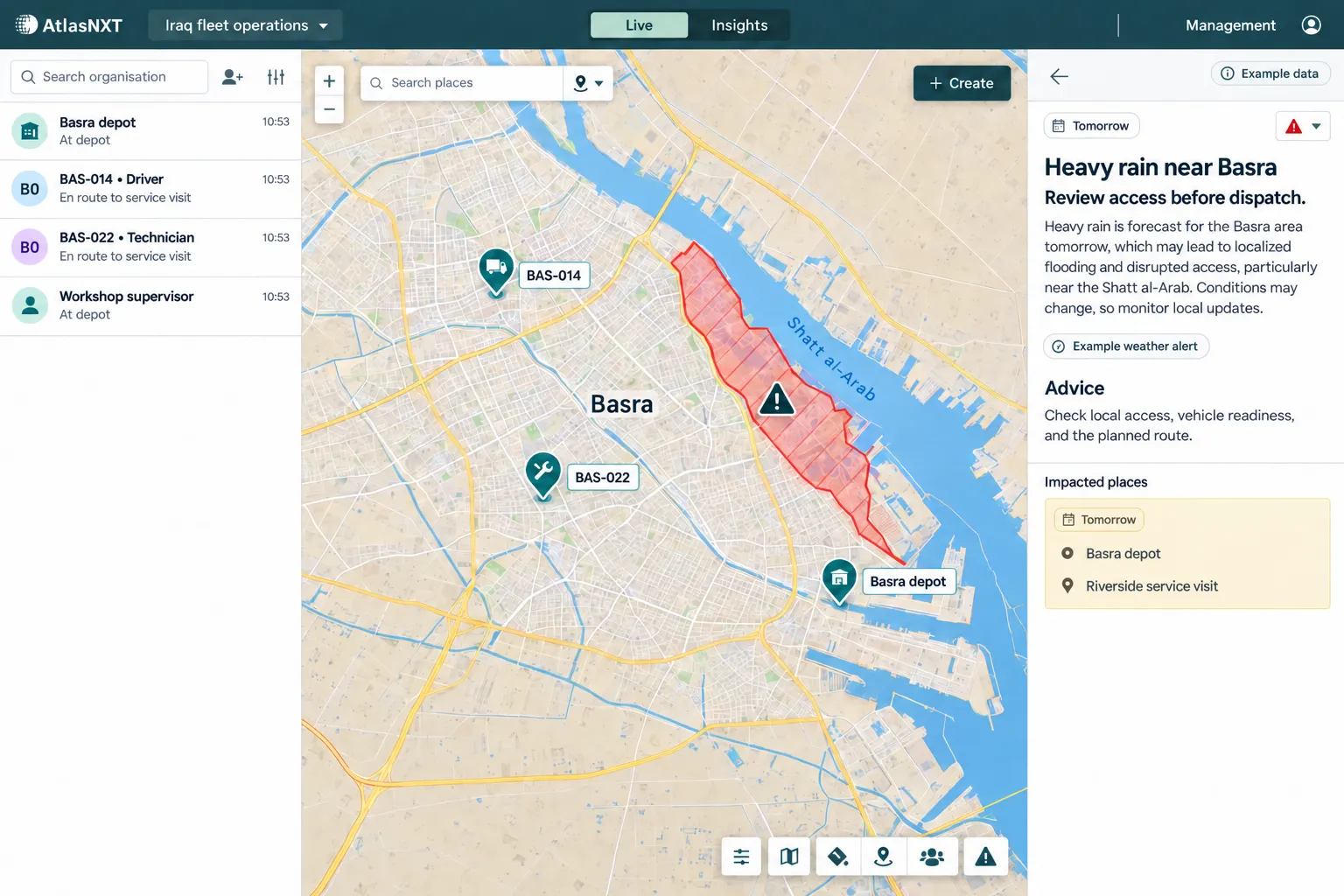
Heavy rain is forecast near Basra. The fleet supervisor uses locations and readiness checks to review dispatch. As conditions deteriorate, the team contacts affected crews, checks their welfare, and follows an agreed procedure when one crew needs help. Follow the same operation through to incident review.
See the warning in context
Review the affected area alongside live fleet locations, the Basra depot, and tomorrow’s riverside service visit.
Explore the whole-platform fleet story
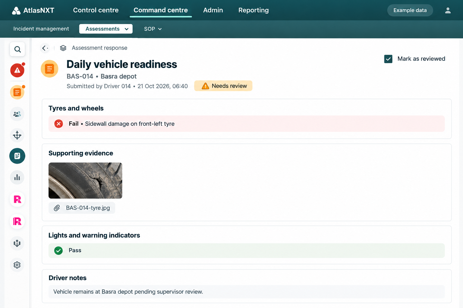
Review the completed check
See who submitted the inspection, when it was submitted, the tyre defect they found, and the supporting photograph.
See the check in the fleet scenario
Understand the exposure. Show the response.
Managers can review the report’s source and time in Global Alerts, the submitter, time stamp, and evidence in Inspections & Assessments, and the tasks and decisions recorded in Incident Management. That gives handovers, operational reviews, and audit preparation a clearer account of what the team checked and did.
Less time comparing separate screens and chasing updates. A clearer basis for dispatch decisions, with evidence available to support the next shift and management review.
Supporting humanitarian security risk management
A partnership grounded in the needs of NGOs.
Track24, the company behind AtlasNXT, is a strategic partner of the Global Interagency Security Forum (GISF). The partnership supports knowledge exchange, resources, and security risk management capacity across the humanitarian sector.
Explore AtlasNXT for NGOsStart with an operation your team recognises.
Bring a construction project, a utility maintenance team, a mining operation, or an NGO field programme to your demo. Walk through a relevant event, identify potential exposure, contact the team, and coordinate the follow-up.
Then use a focused trial to measure time spent reviewing exposure, reaching people, and recording the response against the way your team works today.
Request a trial