


Satellite Communication
Satellite devices provide reliable connectivity in remote or hostile environments where GSM networks are unavailable or damaged. They enable critical communication for safety, navigation, and operational coordination, ensuring that individuals and organisations can send messages, share location data, and request assistance regardless of terrestrial coverage. This resilience makes them particularly valuable for emergency response, maritime and aviation operations, remote fieldwork, and duty-of-care scenarios where uninterrupted communication is essential.
Satellite devices paired with AtlasNXT ensure communication continuity in areas with no GSM signal, from deserts and mountain regions to offshore environments. This guarantees that field teams remain connected to the GSOC, receive updates, and respond to evolving situations, regardless of local infrastructure or network outages.
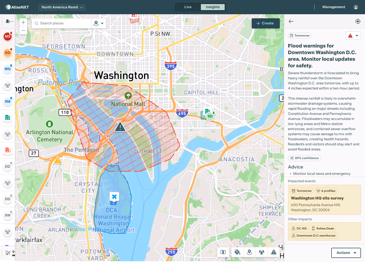
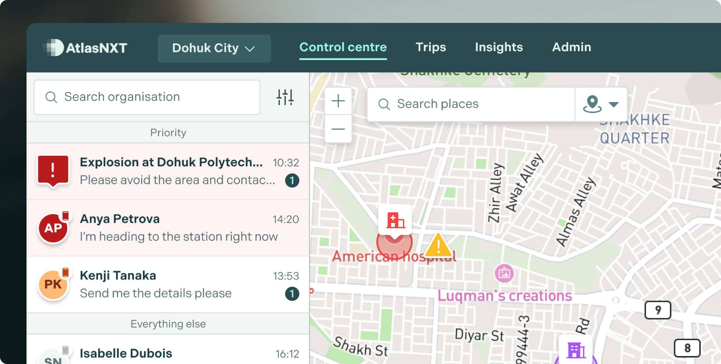
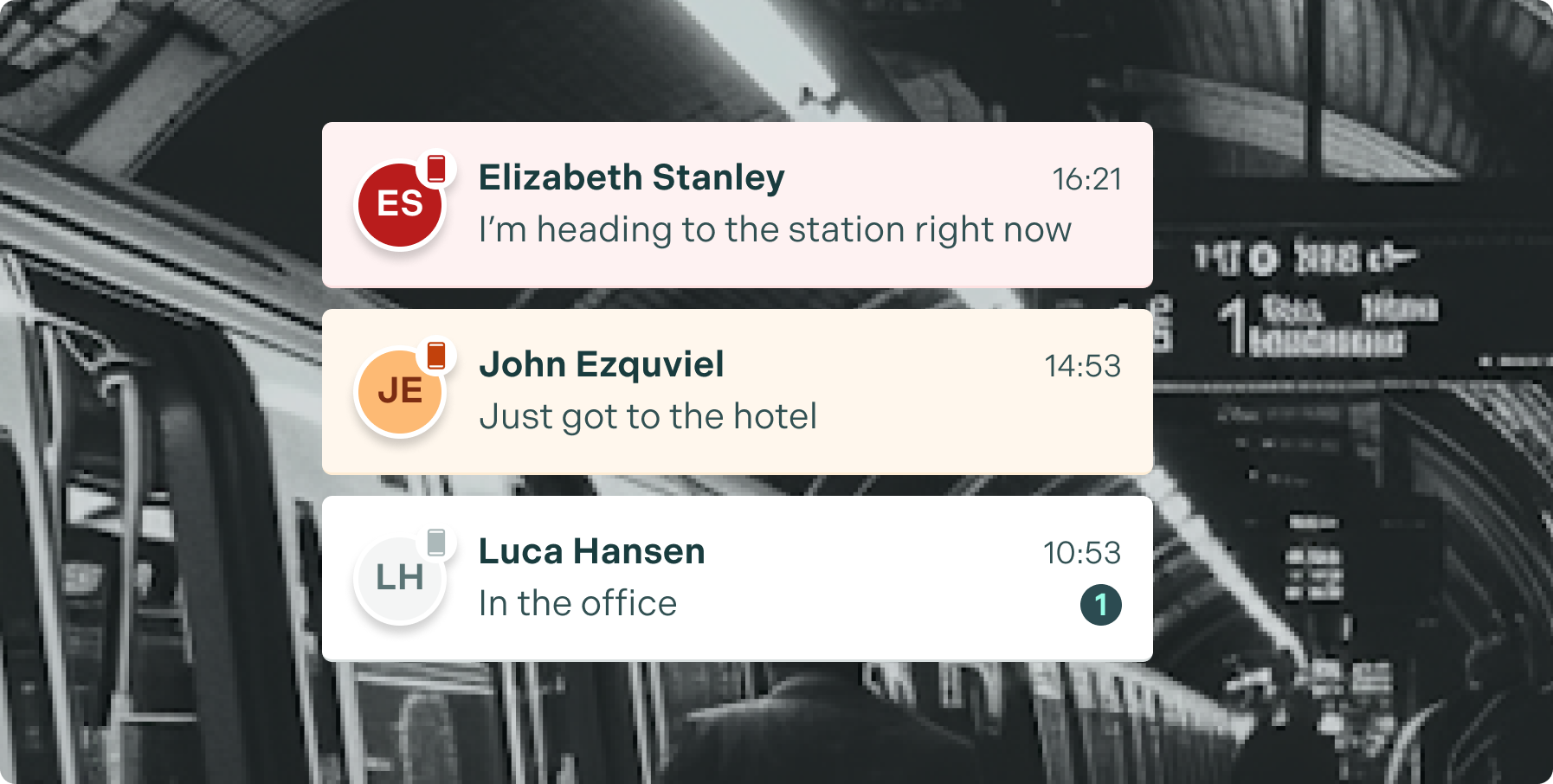
By linking satellite messaging and GPS data directly into AtlasNXT, organisations gain continuous visibility of staff movements and status.Panic alerts, location check-ins, and broadcast instructions can still be sent and received, enabling rapid decision-making and escalation during emergencies when lives and assets may be at risk.
Integrating satellite devices with AtlasNXT builds redundancy into communications planning. If GSM networks are compromised—due to congestion, natural disasters, or security incidents—AtlasNXT can seamlessly shift to satellite inputs, maintaining workflow, reporting, and mission coordination so operations don’t stall when it matters most.
Stay in constant contact anywhere on Earth
Satellite connectivity with AtlasNXT removes the dependency on ground-based networks, giving organisations a communications backbone that travels with their teams rather than relying on what’s available locally. It allows command centres to maintain oversight, receive situational intelligence, and coordinate all assets from a single platform even when conventional channels fail. This combination of mobility, network independence, and platform-level integration turns satellite devices from a last-resort tool into a strategic advantage for any operation working at the edge of coverage.


“With the support of AtlasNXT, we can offer real-time intelligence and tracking features far superior to anything currently on the market."
All the features you need to keep your team safe
See staff and assets update in real time, giving operators instant visibility and enabling faster, better decision making during daily operations or critical events.
AI enabled so operators can automatically create dynamic geofences, triggering alerts the moment people leave or enter areas of risk.
Our Mass Notification system sends alerts instantly across SMS, Push, Satellite, Voice and Email, ensuring that the right people get the right message at the right time, every time. Reach Detection tells you what proportion of your organisation is covered, further supporting you in quantifying risk.