AtlasNXT brings location tracking, welfare checks, communications, and incident management into one platform. Give dispatchers, operations managers, and safety teams a shared view of people working across routes, depots, and customer sites.
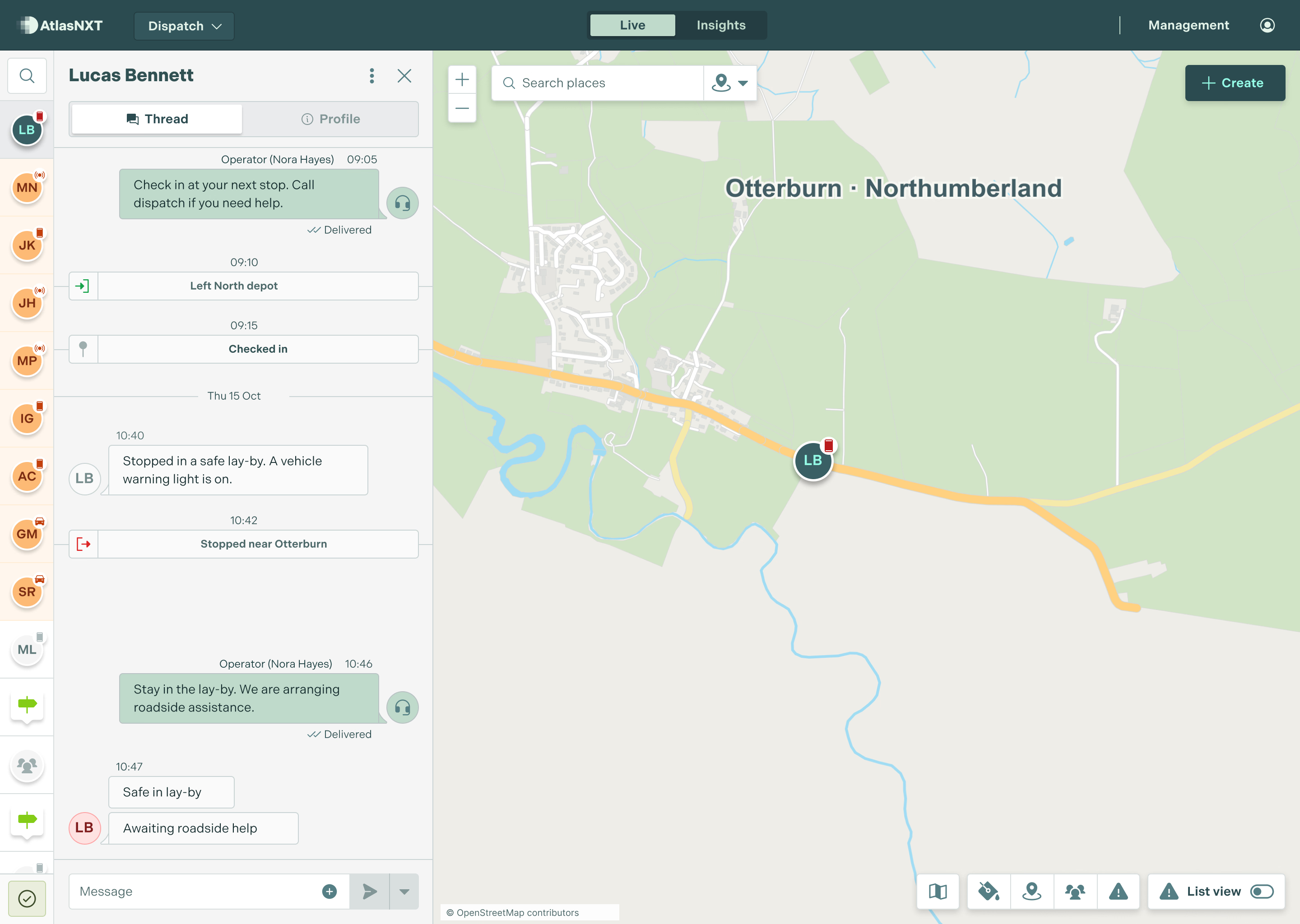
A driver has stopped on a remote road. A technician has not replied from a customer site. See their live or last known location, review recent messages, and contact them from the same operational view. The Mobile Operator App keeps that view available away from the desk.

Set geofences around depots, customer sites, and areas of concern. Receive entry and exit alerts to support your journey procedures.

Contact a driver, a field team, or everyone in an affected area across supported channels. ReachScore™ helps identify contact gaps before the next journey.

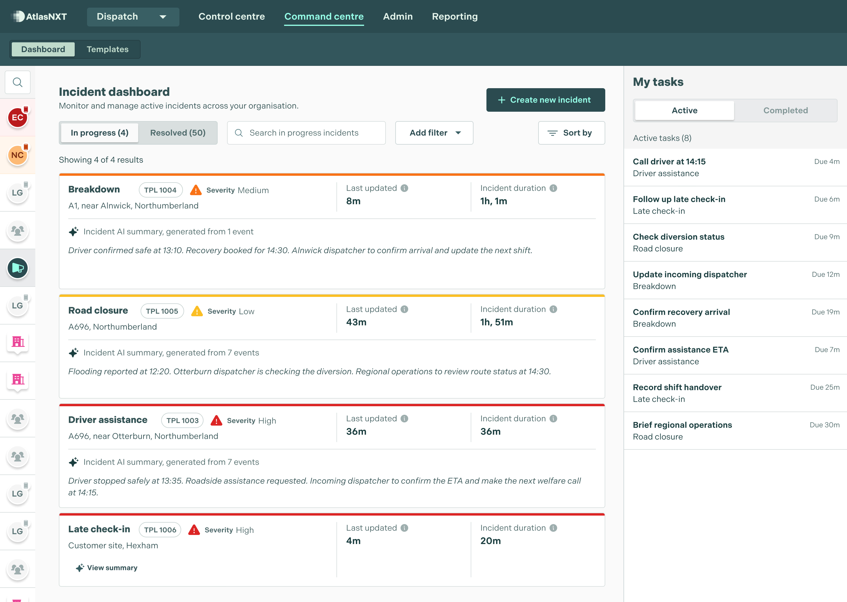
Record a breakdown, injury, or journey disruption. Assign follow-up actions and keep updates together until the incident is closed.

See weather, security risks, and travel disruption alongside your people and locations, helping the team assess an affected journey.
Drivers and field technicians work beyond the reach of a fixed control room. They may travel at night, visit unfamiliar sites, or operate where mobile coverage is unreliable. When plans change, the person responsible for their welfare needs more than a delivery schedule or a string of separate messages.
AtlasNXT gives dispatchers, operations managers, and safety teams a common view. See live or last known locations, request check-ins, and keep an automatic log of all communications with each person. Geofence alerts add context around arrival, departure, and areas of concern.
If someone reports a problem, capture it as an incident and coordinate the response. Assign actions, record decisions, and keep subsequent updates in the same place. The next dispatcher can take over with a clear account of what has happened and what still needs doing.
The Mobile Operator App extends that capability to managers away from their laptops. Compatible satellite devices provide an additional way to track and communicate on journeys beyond mobile coverage. Teams can choose the combination of app and hardware that fits their routes and working conditions.


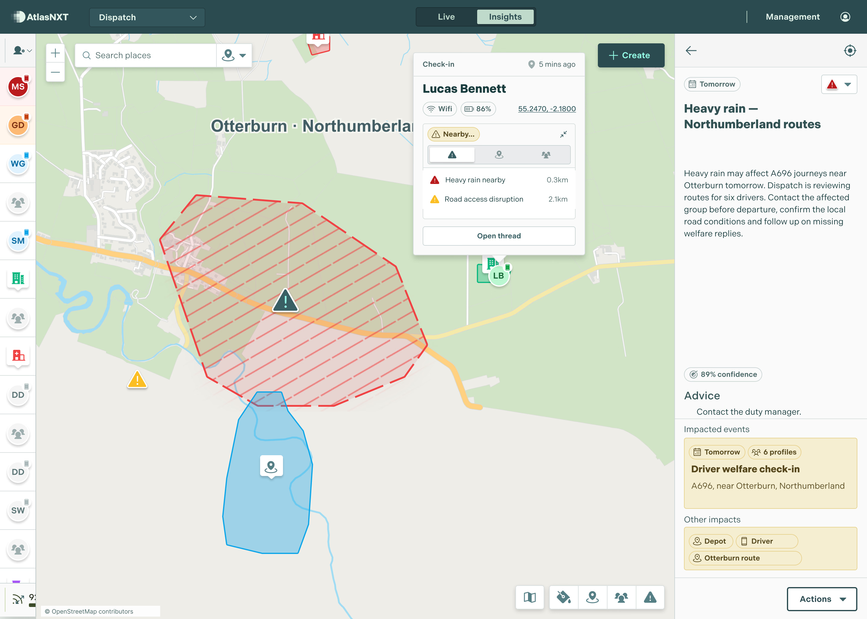
Bring location, welfare responses, and nearby risks into the same view. Use the available information to decide who needs contact, support, or a change of plan.


Let local dispatchers manage their teams while regional operations retain oversight.