
“They were the ones asking me to turn it on”: how NPA Iraq centralised staff safety with AtlasNXT
Norwegian People's Aid's security team in Iraq brought a large, dispersed workforce onto one platform, keeping people visible even in areas with no phone or internet coverage at all. Its Country Security Coordinator Layth Nameer explains how, and why his expatriates became the platform's biggest advocates.
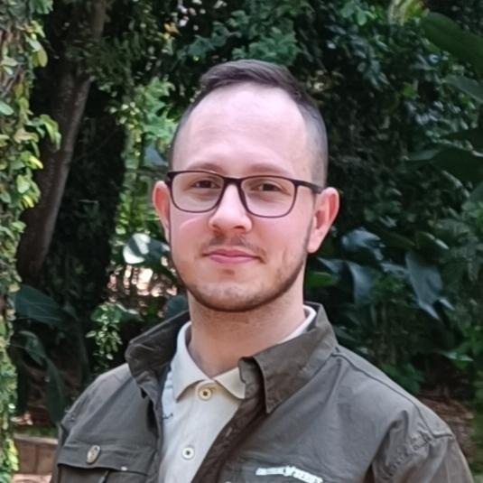
Layth Nameer
Country Security Coordinator
Norwegian People’s Aid Iraq
Organisation
Norwegian People's Aid (NPA) Iraq
Sector
Humanitarian mine action / NGO
Environment
Federal Iraq and Kurdistan Region, including areas with no GSM or internet coverage
Solution
AtlasNXT app, Whisper satellite devices, Overwatch, geofenced hot zones, panic alerting
Scale at peak
~400
staff
100+
vehicles
40–50
expatriate staff
Operating where the map runs out
Layth Nameer is Country Security Coordinator for NPA Iraq, the most senior safety and security role in the country programme. His remit covers security, safety and access across two very different operations: a development programme in the Kurdistan Region in the north, and NPA's largest programme, demining and disarmament, across federal Iraq.
The threat picture spans decades of conflict. “In the north it's the remnants of ISIS,” Layth explains. “In the south, it's the remnants of war: the Iran–Iraq war and the Gulf War.”
At its height, the operation meant overseeing the safety of around 400 employees and more than 100 vehicles, including 40 to 50 expatriate staff spread across some of the most remote terrain in the country.
Especially in the south, there were areas in the desert with no service whatsoever. No internet, no GSM, nothing.
Why NPA Iraq needed a platform
The trigger was scale. Following the liberation of Iraq from ISIS, NPA's operation ramped up rapidly from early 2018: a large fleet and a large workforce spread across unsafe and uncovered environments.
We had to find a solution where we could centralise all of these communications into one app, one service, rather than dispersing communication across multiple security focal points where one person picks something up and another doesn't find out until later.
The answer was a layered approach built around AtlasNXT: the app for staff in connected areas, and Whisper satellite devices for vehicles and teams operating in blackout zones, alongside NPA's existing vehicle tracking and satellite phones for emergencies.
It's four ways of tracking. If it's a vehicle with national or logistics staff, I know where it is. If it's an expat, I can see them on the map. If they're in a blackout zone, I see them through the Whisper devices. If there's no communication at all, we have satellite phones. That's what made me feel confident I could actually track all of our people.
Day to day: from passive monitoring to Overwatch
Much of the value was quiet and constant: passive monitoring of staff locations, with the added detail of knowing whether someone's location was switched on and how much battery their phone had left.
For higher-risk situations, Layth relied on Overwatch, AtlasNXT's enhanced monitoring mode, for irregular movements to new places or through dangerous areas, and for visitors from NPA's Norway headquarters. “I would hand visitors a dedicated phone, show them how to turn Overwatch on, and monitor their location constantly.”
Geofenced hot zones added another safety net. “If a staff member doesn't know about a hot zone and goes into it, I get the notification right away and can react immediately, rather than neither of us knowing they're in a hot zone.”
Behind it all sat panic alerting, which Layth tested regularly and without warning the operations room in advance. “Just so we know how ready we are to receive these alerts, and how reliable it is. It was successful every time.”
“They were the ones asking me to turn it on”
Layth expected his expatriates to be indifferent to the app. The opposite happened.
They've seen everything; they're not easily rattled. But they were the ones asking me for activation. They were asking whether they were visible on the map, whether the panic button was working. It's an indication that they actually feel safer, or at least more seen, knowing they have this app on their phone.
His advice to other NGO security leads
Asked what he'd tell a peer in a similar environment, Layth points to Syria, where conditions today echo post-2003 and post-ISIS Iraq. His answer centres on the journey, not the destination.
You have people at point A and people at point B. The problem is what's between them. If we see a consistent signal moving along the routes we've designed, without deviation, we know nothing is wrong. If we see a deviation, we can act quickly, rather than waiting for someone to arrive and call us or getting confirmation from somebody else.
His second point is centralisation: “It's for everyone to be on the same platform. You open the app and you see all of your staff going in and out. You can check who needs assistance, the messaging, the incidents, all in one place.”
For an NGO with a large field workforce in an unstable environment, he says, satellite devices coupled with the app “will be very important, especially in the coming five years.”
On working with the Track24 team
The customer service was excellent. We don't like jargon, and we don't need to be connected to a CEO. I just need the product, and I need it to be quick.
Whenever I didn't understand anything, I could ask. And it wasn't just me: rather than me teaching them our team would go straight to the source, because they knew they could do that without being made to feel awkward. That was a major positive.
Norwegian People's Aid is one of Norway's largest humanitarian organisations, working in mine action, development and humanitarian disarmament worldwide. NPA Iraq used AtlasNXT to protect staff across demining and development operations in federal Iraq and the Kurdistan Region.