


Stay in touch with remote teams beyond mobile coverage.
Satellite communications for infrastructure project teams. AtlasNXT by Track24 brings messages, location updates, and supported Panic Alerts from compatible satellite devices into the same platform your team uses to coordinate support.
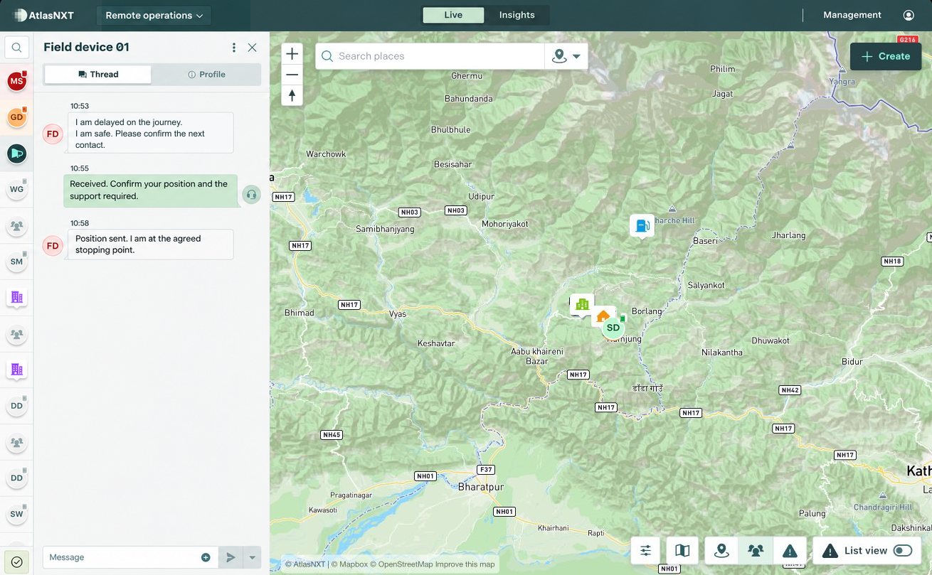
Example scenario
During an inspection of a remote road project near Gorkha, Nepal, an infrastructure engineer is delayed on a section of the journey without mobile coverage. A message from compatible satellite equipment confirms they are safe and asks for the next contact time. The project duty team reviews the reported position, checks what support is needed, and agrees the next update with the site supervisor.


Satellite Communication for infrastructure teams


Which satellite devices and functions can we use?
AtlasNXT is compatible with over 3,000 satellite devices. Request the compatible devices list to check your equipment and the functions available through its integration. Review your intended hardware and service with the AtlasNXT team. Messaging, location reporting, and alert functions depend on the supported integration and configuration.
See Satellite Communication in action
Book a demo for infrastructure project teams. Explore how Satellite Communication fits your sites, contact arrangements, and response procedures.