


Keep official movements in the duty team's view.
Real-time location tracking for government staff. AtlasNXT by Track24 brings shared staff and asset locations into one map. Help embassy and consulate duty teams follow reported movements, consider the age of each position, and focus contact when an official journey needs attention.
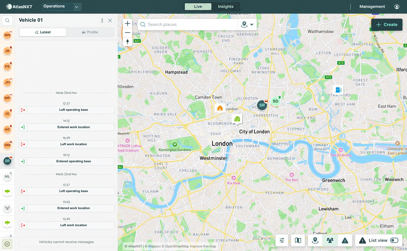
Example scenario
A vehicle travelling between a government office and another work location in London is later than expected. The duty officer reviews the last reported position and timestamp, then contacts the driver. A confirmed access delay explains the change. The visit coordinator updates the onward arrangements, and the incoming duty colleague can see what has been confirmed.


Real-Time Tracking for Government


How can mission teams use location history?
Review reported movements between posts, accommodation, and visit locations. The shared map gives mission and home-country duty teams a common reference for staff contact and journey follow-up.
How are locations and reporting times shown?
Current or last known positions are shown with their reporting times. Location history gives the duty team context for mission journeys and helps colleagues pick up monitoring at handover.
Which satellite devices are compatible?
AtlasNXT is compatible with over 3,000 satellite devices. Request the compatible devices list to check your equipment and the functions available through its integration.
Bring a mission journey into the demo
Review your posts, visiting teams, and contact arrangements to see how location supports the duty team's decisions.