


Libya's oil, gas, and mining operations depend on movement across enormous distances. Personnel travel between fields, facilities, project sites, and accommodation, while vehicles cross large areas of demanding desert terrain. Teams may spend long periods away from populated areas and beyond dependable mobile data coverage.
In those conditions, knowing where people and vehicles are is not simply a question of efficiency. It affects welfare checks, journey management, operational coordination, and the speed of response when something goes wrong. Libya's National Oil Corporation continues to emphasise workplace safety and support for personnel operating across its fields.1
The challenge is that many tracking and communication systems still assume a dependable terrestrial network. That assumption breaks down quickly across vast desert environments, where distance, heat, sparse infrastructure, and inconsistent connectivity shape every movement.
What changes when work moves beyond Libya's mobile coverage?
A mobile application can provide useful location and communication functions while a device has data coverage. Once that coverage disappears, however, the operational picture can become incomplete. A person may still be moving, a vehicle may still be following an approved journey, and a team may still be carrying out safety-critical work, but the control room may no longer receive timely information.
This creates a practical gap between having a tracking process and maintaining visibility throughout the journey. The issue is not whether terrestrial communication has value. Smartphones are often the most practical way to support tracking, communication, welfare checks, and alerts where cellular data is available. The question is whether the organisation has a suitable alternative when that coverage ends.
National coverage figures should also be interpreted carefully. International Telecommunication Union data reported that 98 per cent of Libya's population was covered by a mobile-cellular network in 2022.2 Population coverage, however, does not demonstrate that every desert route, field location, mine, or temporary worksite has a dependable data signal. Operational planning must reflect the places where people actually travel and work.
Satellite communication provides that alternative. Garmin's professional inReach service is designed to support off-grid tracking, messaging, field-data collection, and logistics coordination, with an application programming interface that allows inReach data to be integrated into a wider operational platform.3
Can existing Garmin inReach Mini devices form part of the solution?
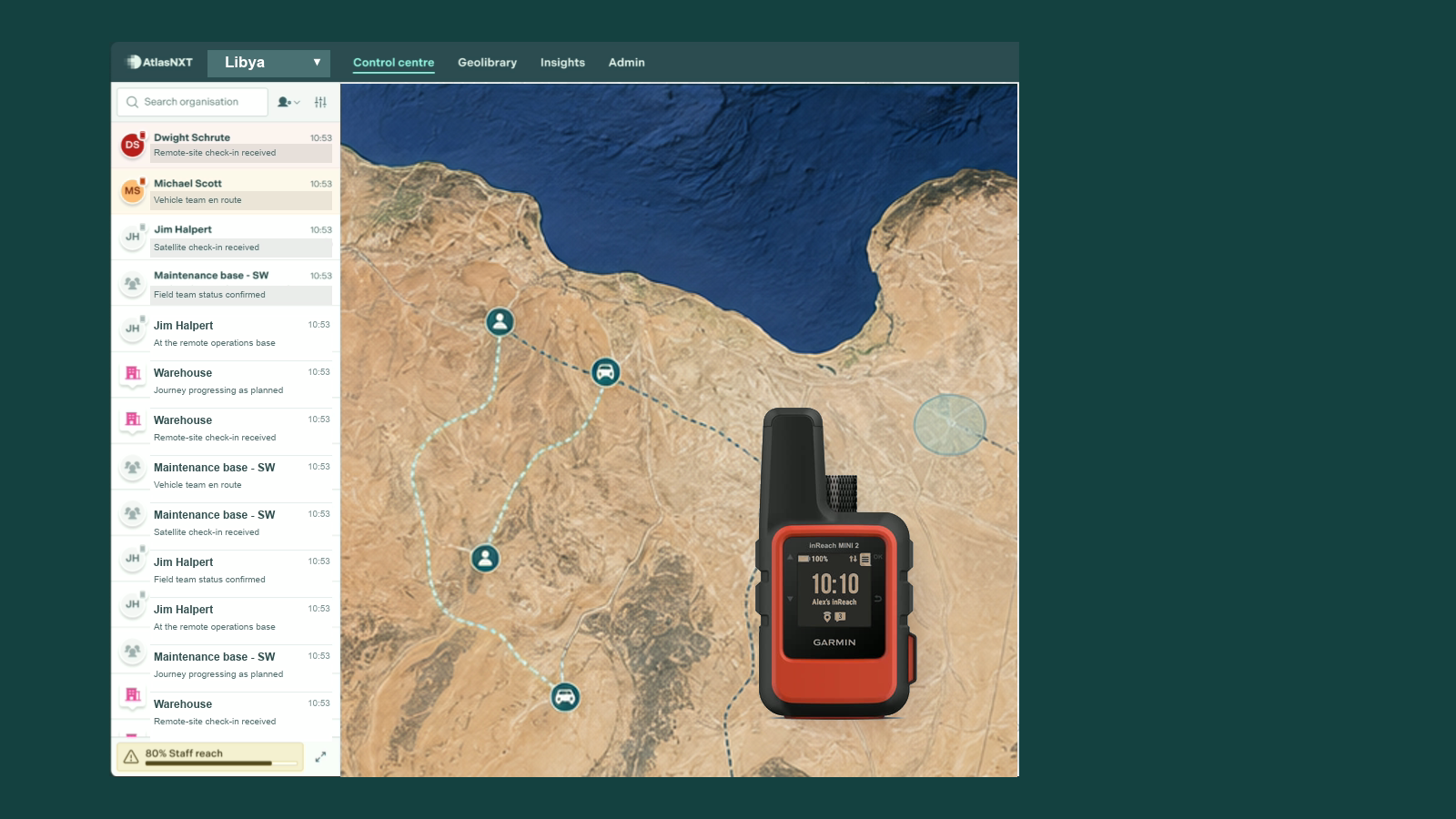
Yes. Garmin inReach Mini devices can provide a practical communication and tracking layer for personnel working beyond mobile coverage. AtlasNXT supports smartphones alongside Garmin inReach devices, allowing Libyan operators to use cellular connectivity during normal operations and default to Garmin satellite communication where there is no cellular data signal.
This mixed-device approach is especially relevant across Libya's oilfields, mines, processing sites, exploration areas, and the long desert routes between them. Different teams may move in and out of coverage during the same working day. Their visibility should not depend on every location having the same communications infrastructure.
This also matters because an organisation may already have suitable devices in the field. A better approach does not necessarily begin by replacing working smartphones or satellite communicators. It begins by asking whether information from both can be brought into the same operational view as personnel, vehicles, journeys, alerts, and response activity.
Garmin states that the inReach Mini uses the Iridium satellite network for two-way text messaging. Messages can include the user's location details, allowing a remote worker to communicate even when a conventional cellular connection is unavailable.4
The inReach Mini supports location tracking and is one of over 3,000 satellite devices compatible with AtlasNXT.
Why is a shared operational picture important across Libyan sites?
A satellite device can generate valuable information, but information becomes more useful when it reaches the people who need to interpret and act on it.
If smartphone tracking sits in one system, satellite tracking in another, vehicle data elsewhere, and journey plans and incident records in further systems, the control room must reconstruct events across several screens. That takes time and increases the chance that context will be missed.
A joined-up platform can bring these signals into one operational picture. A location update can be considered alongside the person's assigned journey, the vehicle they are using, the expected check-in schedule, nearby risks, and any active incident. The value lies not only in seeing a point on a map, but in understanding what that point means.
For example, a missed welfare check has a different significance when the person's last satellite-reported location is consistent with the approved route than when it shows an unexpected deviation. Similarly, a stationary vehicle may be unremarkable at a worksite but require attention when it stops for an extended period in an isolated area.
What should organisations expect from Garmin integration?
The integration should make satellite-connected personnel visible within the organisation's normal operating process. Location data should support a clear understanding of where people are, while messages and alerts should reach the teams responsible for monitoring, escalation, and response.
It should also allow the organisation to work across different connectivity conditions without fragmenting its duty-of-care arrangements. Personnel near an office, processing facility, or connected worksite may use smartphones, while teams further into remote terrain rely on Garmin inReach devices. The control room should not need a separate concept of safety for each communication channel.
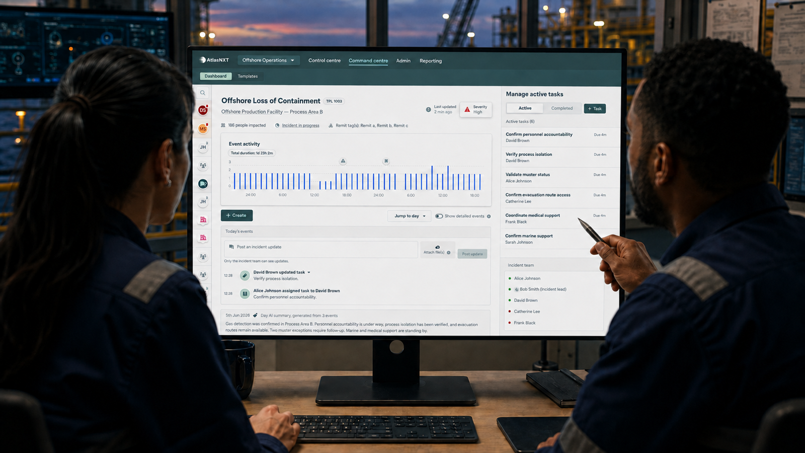
AtlasNXT brings real-time tracking, trips, satellite communication, mass notification, and incident coordination into a common environment.
Does satellite connectivity remove every operational risk?
No. A satellite device is part of a system of work, not a substitute for one. Organisations still need clear journey plans, device-assignment records, charging and testing procedures, check-in expectations, escalation paths, and trained responders.
Garmin advises users to maintain an active satellite subscription, test the device before use, and ensure a clear view of the sky for satellite access.5 These practical conditions should be reflected in procedures, training, and pre-departure checks.
The organisation must also decide who monitors incoming information, what constitutes an exception, how quickly an alert should be assessed, and when an external response should be initiated. Technology can improve visibility, but responsibility still depends on a clear and rehearsed process. Guidance for oil and gas operations similarly stresses emergency planning, trained responders, communication with field workers, and regular drills.6
What does good remote tracking look like in practice?
Good remote tracking gives Libya's oil, gas, and mining operators continuity. Personnel do not disappear from the operational picture simply because a mobile signal ends. Smartphones support routine visibility where cellular data is available, while Garmin inReach devices maintain a satellite communication and tracking option beyond that coverage. Vehicles and journeys remain connected to the people responsible for them, and information from both channels can be considered alongside other operational data.
For operators working across demanding terrain, the ability to use smartphones and Garmin inReach Mini devices within a broader platform is particularly valuable. It allows existing field equipment to become part of a more coherent approach to tracking, communication, duty of care, and incident response.
The goal is not to collect more dots on a map. It is to ensure that, wherever work takes place, the organisation can understand who is moving, whether a journey is progressing as expected, and what action is required when circumstances change.
Book a Complimentary Consultation to see how smartphones, Garmin inReach devices, personnel tracking, vehicle visibility, and incident coordination can work together in one operational view.
References
1. Libya National Oil Corporation, Chairman Inspects Progress at Several Oil Fields
2. International Telecommunication Union, Digital Development in Libya
3. Garmin, Customised Web Portal for inReach Professional
4. Garmin, inReach Mini Owner's Manual: Messages
5. Garmin, inReach Mini Owner's Manual
6. US Occupational Safety and Health Administration, Oil and Gas General Safety