

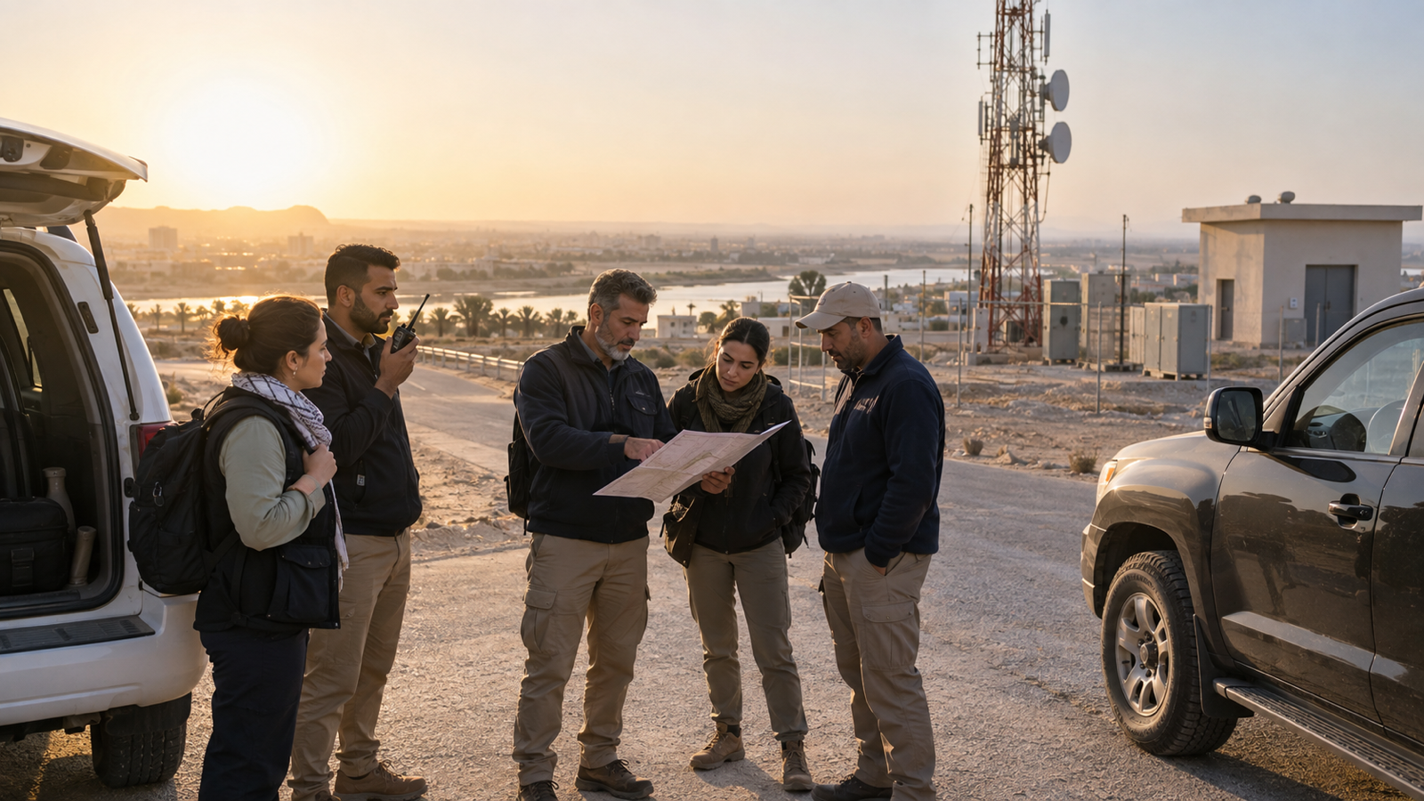

Iraq's National Development Plan for 2024 to 2028 addresses oil, electricity, manufacturing, extractive industries, transport, storage, communications, construction, and digital transformation.1 These sectors have different technical systems and risk profiles, but many can involve work away from a central office, movement between locations, and a need to remain connected to colleagues who may provide support.
Roads carry more than 90 per cent of transport activity in Iraq, according to the World Bank, and current investment is intended to strengthen major corridors connecting population centres, industrial areas, agricultural areas, and borders.2 The energy system is also evolving. The International Energy Agency describes Iraq as holding abundant oil and gas resources, having strong solar potential, and planning further change in generation and supply.3 It is reasonable to infer that field operations will continue to combine established assets, new projects, specialist contractors, transport movements, and geographically dispersed work.1, 2, 3
No single device or screen resolves that operating challenge. A useful platform must support routine work before anything has gone wrong, help users raise or answer a concern, preserve the limits of the information received, and provide a controlled route into incident management when the situation requires it.
AtlasNXT is most valuable when it is configured as that operating model. The app can support everyday communication and duty-of-care functions where cellular data is suitable. Where current Iraqi rules and the relevant device and service authorisations permit, compatible satellite devices can extend selected workflows for users beyond reliable coverage. Remits can align visibility with geographic responsibility. Check-Ins, Panic, and Overwatch can support defined procedures, while the Incident Room can connect material updates, tasks, communications, decisions, and status changes once an event needs coordinated management.
The following questions help separate useful capability from a list of features.
What should the platform do before an incident exists?
Duty of care is easier to manage when routine operations create clear expectations. The organisation should know which people or teams are working, the areas for which each control function is responsible, what communication method is appropriate, when contact is expected, and what should happen when reality differs from the plan.
AtlasNXT can support this through Remits, authorised people and location information, alerts, Check-Ins, and Overwatch. These capabilities should be configured around actual roles rather than applied uniformly. A field engineer visiting several sites may need a different workflow from a driver following a regular route, a senior manager travelling between offices, or a contractor entering a project area for one shift.
The routine state matters because it gives an exception meaning. A Check-In that arrives on time can close a planned welfare step. A non-response can enter the agreed follow-up process. An unexpected change in location may require verification when location use is authorised and relevant. A Panic activation can be connected to the person, time, available location, and response procedure rather than arriving as an isolated alarm.
This does not require permanent monitoring of everyone. It requires the organisation to decide which operational questions matter and select the least intrusive capability that can answer them. The platform should make the agreed workflow easier to follow, not create a new expectation that operators watch every person continuously.
Why should the AtlasNXT app usually be the starting point?
Where cellular data is suitable, a smartphone can be a practical primary device for users who are authorised and equipped to carry one because they can interact directly with the AtlasNXT app. The app can support alerts, Check-Ins, Panic, Overwatch, and location-enabled functions where they are appropriate to the role and authorised by the organisation.
That does not mean mobile connectivity should be assumed at route or site level. Iraq's Communications and Media Commission reports that mobile adoption is strongest in urban areas, while coverage and service quality vary across the country and rural areas can face material limitations.4 A deployment should therefore test the routes, sites, and working conditions that matter rather than treating a national coverage figure as an operating guarantee.
The app also allows a communication to ask for a defined response. That distinction matters. A general message may inform someone, but a Check-In can ask the recipient to confirm a specific status within a stated time. The response choices and follow-up procedure remain the organisation's responsibility.
Technology should sit inside a management process. The UK Health and Safety Executive's lone-working guidance says monitoring systems should be embedded in the organisation and understood by workers, with clear procedures and effective means of communication. It identifies pre-agreed contact intervals and devices for raising an emergency alarm among possible controls.5 The legal duties in Iraq must be assessed under the relevant local requirements, but the operating principle is useful: issuing an app does not replace the procedure that explains when and how it should be used.
Implementation should therefore begin with user groups and situations. The organisation can define which alerts each group receives, when a Check-In is appropriate, who monitors responses, what a non-response means procedurally, and which roles may activate or receive Overwatch. The app then becomes the familiar front end to a designed process rather than a collection of buttons awaiting interpretation.
Where should compatible satellite devices enter the model?
Satellite support should be selective and planned. It is not necessary for every user, and it should not be presented as an automatic replacement for the smartphone workflow. The right question is which people, locations, or tasks face a material consequence if cellular communication is not available when contact is required.
Iraq's National Emergency Telecommunications Plan is public-sector emergency guidance rather than a rule for commercial employers, but its design logic is relevant. It calls for continuity plans, standard operating procedures, more than one communications link, alternative equipment and links including satellite provision, and regular exercises.6 That planning logic does not itself authorise commercial satellite tracking or any particular device.
The International Telecommunication Union notes that mobile-satellite systems can operate independently of local communications infrastructure that may be interrupted, which is one reason satellite communications can support emergency and resilience arrangements.7 That principle is relevant to remote or exposed work, but the actual capability depends on the selected device, satellite service, airtime, configuration, operating environment, and user procedure.
Where current Iraqi rules and the relevant device and service authorisations permit, AtlasNXT is compatible with selected satellite devices. An organisation might allocate them to particular field roles, vehicles, sites, or movements after assessing where the additional layer is justified. A user may follow the normal app-based process when cellular data is suitable and use a permitted, configured satellite device where the operation expects cellular service to be unavailable.
This is not a claim of automatic switching between cellular and satellite, continuous tracking, guaranteed message delivery, or permission to use any device or service in Iraq. The organisation must verify the current regulatory position and define what each approved device can do, which messages are expected, who monitors them, how often equipment is checked, and what happens when contact remains unsuccessful.
The most important design work occurs at the receiving end. A satellite message that reaches an unmonitored account has not created an effective response. The control team needs to recognise the source, understand its meaning, connect it to the right person or operation, and take the next step under an agreed procedure.
How can Remits turn geography into operational responsibility?
National or multi-site operations should not depend on one undifferentiated view. People responsible for a particular region, group of sites, project area, or operational portfolio need enough information to act without automatically receiving access to everything else.
AtlasNXT Remits can define geographic responsibilities and authorised views. A local operations team can work within its area, a regional lead can oversee several related areas, and an approved central function can receive the wider view required for coordination. The exact structure should follow the customer's organisation, authority model, and information-handling rules.
This becomes useful when an event crosses boundaries. A disruption in one area may affect a team travelling towards it, a vehicle assigned elsewhere, or a specialist required by another site. The incident lead needs a controlled way to widen the scope without turning every local issue into a national notification.
Remits should therefore be designed around action as well as visibility. For each area, the organisation should identify who monitors routine exceptions, who receives a Panic activation, who can launch a Check-In, who may open or join an incident, and when responsibility transfers to another level. A map boundary is useful only when the operating responsibilities behind it are understood.
What should a Check-In prove?
A Check-In should answer a defined operational question. It might ask whether a person is safe, whether a team has arrived, whether assistance is required, or whether a specific instruction has been understood. The question and response choices should be brief enough to use under pressure and precise enough to guide the next action.
The resulting statuses must retain their meaning. “Sent”, “delivered”, “responded”, “reported safe”, “needs assistance”, and “no response” are not interchangeable. A device response may be direct evidence from the user. A manager's confirmation may be valid but comes from a different source. A last-known location may help prioritise follow-up without proving present welfare.
AtlasNXT can show responses and non-responses to a Check-In. The platform does not turn silence into an emergency automatically. The organisation defines the time window, review threshold, alternate contact method, and escalation route. A short window may be appropriate during a fast-moving event, while a longer one may fit a planned welfare check whose risk and communication conditions differ.
The affected population also needs review. Sending a Check-In to every person in a national directory can create a large response burden without improving the decision. The organisation should identify who could reasonably be affected using authorised rosters, work assignments, geographic scope, known site presence, or other suitable information. The scope can widen as evidence changes.
ReachScore™ is built-in to AtlasNXT. It can help expose communication-readiness gaps during planning and review, advising the proportion of people who can be reached, and providing a list that requires remediation, with an explanation of the reason why for each individual.
How should Panic and Overwatch connect to a real response?
Panic and Overwatch are useful only when the organisation has defined what happens at the other end. A Panic activation should enter a monitored process that identifies the user, time, available context, and the person responsible for the first response. Overwatch should support the agreed period of attention and communication rather than imply that a control room can prevent every event.
The first operator action may be to contact the user, confirm the nature of the concern, review authorised location or assignment information, notify an appropriate supervisor, or open an incident. The correct sequence depends on the customer's procedure. AtlasNXT should make that procedure easier to execute and record, not silently invent the decision.
False or accidental activations should remain part of the record at the level required by policy. They can reveal a training issue, device problem, or unclear interface, and they should be closed with a reason. Repeated nuisance alarms should lead to investigation and improvement rather than a general lowering of attention.
When should a routine exception become an Incident Room?
Not every late response or operational change requires full incident coordination. The organisation should define activation criteria based on consequence, uncertainty, the number of people or sites involved, the need for cross-functional work, and the level of authority required.
ISO 22320 describes incident management in terms of process and structure, including roles and responsibilities, tasks, resource management, joint direction, and cooperation. It applies to organisations responding alone and to several organisations working together while retaining their own structures.9 That provides a useful design test for the transition into an AtlasNXT Incident Room.
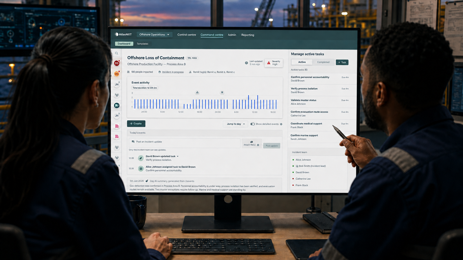
Once activated, the Incident Room can keep significant updates, communications, tasks, decisions, and status changes with the event. An operator can distinguish a new report from an assessment. A task can identify one owner and a review time. A material decision can retain its rationale and the information available when it was made. A handover can begin from the maintained record rather than from a reconstruction of calls and messages.
The platform should not replace technical systems. A network operations centre, security operations centre, supervisory system, fleet platform, or specialist safety tool should remain authoritative for its own technical purpose. Relevant consequences or authorised data can enter the incident workflow when permissions, formats, security controls, and an approved integration or import support them.
The value is not that everything appears on one screen. It is that the people managing the response can see what matters to the event, what remains uncertain, who owns the next action, and when the position will be reviewed.
Can existing organisational data support the workflow safely?
A duty-of-care platform is more useful when it begins with reliable organisational information, but more data is not automatically better. Names, roles, contact details, site assignments, vehicle relationships, contractor rosters, and geographic responsibilities can all help when they are current, relevant, and authorised.
AtlasNXT can use suitable data through approved imports or integrations where permissions, format, configuration, and security requirements support them.
Provenance should survive the import. An incident operator needs to know whether a person-site relationship came from a current roster, a planned assignment, an access record, or a manual update. If two sources disagree, the discrepancy should be visible and assigned for resolution rather than concealed by whichever feed updated last.
Data quality also requires an operational owner. A technically successful synchronisation can still reproduce an outdated team structure. The business function responsible for the source should define what “current” means, how changes are approved, and how exceptions are corrected.
How can location support safety without becoming blanket tracking?
Location should answer a legitimate operational question. It may help establish whether a user has reached a location, support Overwatch for a defined activity, identify who may be affected by an event in an area, or provide context after a Panic activation. Those purposes do not all require the same frequency, precision, or duration.
The OECD Privacy Guidelines set out principles including collection limitation, data quality, purpose specification, use limitation, security safeguards, openness, individual participation, and accountability.11 The applicable legal requirements must be assessed for Iraq and for any other jurisdiction in which relevant data is processed, but these principles provide a practical design discipline.
AtlasNXT location can be live, event-led, or consent-based where appropriate. The customer should select the model that fits the role, purpose, workforce arrangement, and applicable requirements. Users should understand when location operates, why it is required, who can see it, and when it stops.
Remits can help limit visibility to authorised responsibilities. Incident access may be wider than routine access when the approved response requires it, but that expansion should have a defined purpose and endpoint. Closure should remove temporary access in line with policy.
What should a phased deployment in Iraq look like?
A strong deployment begins with a bounded use case rather than an attempt to configure every team at once. The organisation can choose a representative operation with clear ownership, a manageable user group, and a real mix of office, site, vehicle, and field activity.
The first phase should define the users, Remits, communication methods, Check-In questions, Panic response, Overwatch procedure, incident activation criteria, data sources, and leadership view. Where cellular data is expected to be suitable, the AtlasNXT app can be the primary user interface. Compatible satellite devices can be assigned only where current Iraqi rules and the relevant device and service authorisations permit, and where the assessment justifies them.
The second phase should test routine exceptions. The team can allow a Check-In to go unanswered, introduce an outdated roster entry, move a user between Remits, and require a control-room handover. The objective is to see whether operators can recognise the gap, find the approved procedure, assign an owner, and preserve the evidence.
The third phase should activate the Incident Room. A scenario can involve more than one site, a contractor, a vehicle, conflicting information, and a decision requiring senior authority. The exercise should measure how quickly the team establishes scope, assigns tasks, records decisions, communicates with affected users, and produces a concise leadership view.
ISO 22398 recommends good practice for planning, conducting, and improving exercise projects and allows the approach to be adapted to an organisation's objectives, resources, and constraints.12 ITU guidance on emergency telecommunications also emphasises governance, roles, contingency arrangements, stakeholder coordination, capacity development, and drills.13 These principles support testing the operating model as a whole rather than demonstrating each feature separately.
What should an AtlasNXT demonstration prove?
A useful demonstration should resemble the organisation's work in Iraq. It should not begin with a perfect map and a fully explained emergency. It should begin with an ordinary operation and allow the picture to become incomplete.
The demonstration might show an app user completing a routine Check-In while another selected user communicates through a permitted, compatible satellite device outside reliable cellular coverage. It can show Remits directing visibility to the appropriate teams, a non-response entering the agreed procedure, and a Panic activation providing available context without claiming more than the evidence supports.
It should then show the transition into the Incident Room. The team should be able to define the affected population, record a significant update, allocate a task, preserve a decision, show an unresolved dependency, and prepare a handover. If authorised sample data is used, the demonstration should explain its source and the limits of any proposed import or integration.
The final test is whether the audience can see how the platform supports judgement rather than pretending to replace it. AtlasNXT should help the organisation use mobile and satellite communications appropriately, connect routine duty-of-care activity with incident management, control information through Remits, and keep an accountable record of what happened next.
Book a Complimentary Consultation to explore how the platform could be configured around your people, vehicles, sites, communications, and incident procedures in Iraq.
References
1. Republic of Iraq Ministry of Planning, National Development Plan 2024 to 2028. https://www.mop.gov.iq/documents/economic-policies/development-plans/National%20Development%20Plan%202024-2028.pdf
2. World Bank Group, New US$900 million World Bank financing to improve Iraq's road connectivity and support job creation, 5 June 2026. https://www.worldbank.org/en/news/press-release/2026/06/05/new-us-900-million-world-bank-financing-to-improve-iraq-s-road-connectivity-and-support-job-creation
3. International Energy Agency, Iraq: Energy system. https://www.iea.org/countries/iraq
4. Iraq Communications and Media Commission, The role and importance of developing broadband infrastructure in the ICT and digitization sector in Iraq. https://cmc.iq/wp-content/uploads/2025/08/The-role-and-importance-of-developing-broadband-infrastructure-in-the-ICT-and-digitization-sector-in-Iraq-in-English-white-paper.pdf
5. UK Health and Safety Executive, Protecting lone workers: How to control the risks of working alone, INDG73(rev4), 2020. https://www.hse.gov.uk/pubns/indg73.pdf
6. Iraq Communications and Media Commission, National Emergency Telecommunications Plan. https://cmc.iq/wp-content/uploads/2025/10/National-Emergency-Telecommunications-Plan.pdf
7. International Telecommunication Union, Emergency radiocommunications. https://www.itu.int/en/ITU-R/information/Pages/emergency.aspx
8. UK Health and Safety Executive, Managing the risk of violence and aggression: Personal communication devices. https://www.hse.gov.uk/healthservices/violence/do.htm
9. International Organization for Standardization, ISO 22320:2018 Security and resilience: Emergency management: Guidelines for incident management. https://www.iso.org/standard/67851.html
10. Iraq Communications and Media Commission, Controls for licensing the service and use of Global Positioning System tracking technology, second edition, February 2025. View the official CMC source
11. Organisation for Economic Co-operation and Development, Recommendation of the Council concerning Guidelines Governing the Protection of Privacy and Transborder Flows of Personal Data. https://legalinstruments.oecd.org/public/doc/114/body-text.en.html
12. International Organization for Standardization, ISO 22398:2013 Societal security: Guidelines for exercises. https://www.iso.org/standard/50294.html
13. International Telecommunication Union, Guidelines for national emergency telecommunication plans, 2020. https://www.itu.int/pub/D-HDB-EMER