


Why does a shared incident picture matter in Iraq?
Iraq’s current development priorities span digital transformation, systems automation, oil, electricity, transport, storage, communications, construction, and other infrastructure-intensive sectors.1 The World Bank also describes transport and energy as the largest parts of its active Iraq portfolio, within a wider national emphasis on rebuilding infrastructure and improving public services.2 The International Energy Agency, meanwhile, highlights the continuing strategic weight of Iraq’s oil and gas resources and the expected development of its energy system.3
The operational implication is that expanding infrastructure and greater use of digital systems can produce more signals across more functions.1 A network alarm may arrive in one control room. A security concern may be reported by telephone. A field engineer may send a message from a remote site. A vehicle may be delayed on an access route. A facilities team may hold the latest information about power, cooling, or fire systems. Senior management may receive a shortened account through a separate channel.
Each fragment can be correct and still fail to provide an adequate basis for action. The central question is not whether an organisation has data. It is whether the right people can establish a sufficiently reliable account of what has happened, what it means, who is affected, what is being done, and which decisions remain open.
This is the purpose of a shared incident picture. It is not another monitoring console. It is the operational bridge between detection and coordinated response.
Why is an alarm not yet an incident picture?
Modern operational monitoring is designed to observe technical state. In telecommunications, for example, International Telecommunication Union guidance describes performance, configuration, fault, and log management for power, cooling, and building-environment equipment at network sites. These functions cover measurements, alarms, events, timestamps, equipment states, and intervention management.4 Similar principles apply in other specialist environments. A supervisory system may identify an abnormal process condition, an aviation safety system may surface relevant data, and a security operations centre may detect a threat-related event.
These capabilities are essential because they tell specialists that something has changed. They are not, by themselves, a complete model of the organisational response.
Consider a technical alarm at a remote communications site. The network team may know that mains power has failed and battery capacity is declining. The facilities team may know that the generator has not started. The field operations team may know that the nearest engineer is delayed. Security may know that access to the area requires additional controls. A manager may know that the site supports a priority customer or a safety-critical service. The alarm is one fact within the incident, not the incident in full.
The distinction matters because technical severity and operational consequence are different judgements. A high-severity alarm may be contained by redundancy and have little immediate effect on people or services. A modest technical fault may become a serious operational problem if it affects the only available communications route for a remote team, delays a flight-related process, or removes visibility of personnel in an exposed area. An incident picture must preserve the technical assessment while adding operational context.
It must also make uncertainty visible. A field report is not automatically verified because it is urgent. A location point does not prove that a person is safe. A sent message does not prove that it was received, understood, or acted upon. Good incident management separates observation, assessment, decision, and action instead of allowing them to merge into a single stream of confident-sounding updates.
What makes a shared picture different from a crowded dashboard?
The Joint Emergency Services Interoperability Principles define a common operating picture as an overview created by assessing and fusing information from multiple sources, then sharing it with the appropriate command and coordination groups to support joint decision-making.5 That definition contains two important ideas. Information must be assessed, not merely collected, and the resulting picture must serve a defined decision-making structure.
A crowded dashboard can display hundreds of events without answering the questions that matter. A useful incident picture should make clear what is happening now, what the current information means, what may happen next, and what is being done about it. It should identify the affected area, people, services, assets, and dependencies. It should show which information is confirmed, which remains provisional, and when each significant item was last updated. It should connect actions to named owners and expected times, and it should preserve the reasoning behind material decisions.
This does not require every source system to be collapsed into one undifferentiated pool. Technical detail should remain available to the specialists who can interpret it. The shared layer should present what the wider response needs, with a clear route back to source, provenance, and time. A field report should not overwrite a sensor reading. A sensor reading should not silence credible human observation. Where the two conflict, the disagreement is itself operationally important and should be visible until it is resolved.
The result is less like a wall of alerts and more like a maintained operational account. It records what the organisation currently believes, why it believes it, what it has decided, and what evidence could change that view.
How should monitoring and people-centred incident command divide the work?
Network Operations Centres (NOCs), Security Operations Centres (SOCs), Supervisory Control and Data Acquisition (SCADA) systems, fleet platforms, aviation systems, and facilities tools should continue to perform the specialist functions for which they were designed. A shared incident-management layer should not attempt to reproduce their technical depth or displace the teams accountable for those systems.
Its role begins where consequences cross boundaries. A network failure can become a field-safety issue. A security report can affect an engineering visit. A road closure can alter crew movement, maintenance priorities, and customer communications. A facilities event can affect service continuity. A developing aviation issue can require coordination across airside operations, ground teams, contractors, transport, and leadership.
ISO 22320 describes incident management in terms of process and structure, with attention to roles and responsibilities, tasks, resources, joint direction, and cooperation. The standard applies to organisations responding to incidents of different types and scales, including situations in which multiple organisations retain their own structures while working together.6 This is a helpful test for any incident platform. It should not merely show that an event exists. It should support the human structure through which the event is assessed and managed.
The technical lead should remain the authority on technical diagnosis and restoration. The security lead should retain ownership of security assessment. The safety lead should retain the relevant safety responsibilities. Incident leadership should integrate those perspectives, set objectives, expose dependencies, resolve competing priorities, and maintain an overall account of progress. Clear boundaries protect expertise. Shared visibility prevents those boundaries from becoming information barriers.
How can fragmented reports become decision-grade information?
During a cross-functional incident, communication may be abundant, uneven, and difficult to reconcile. Calls, radio traffic, messaging applications, emails, alarm consoles, spreadsheets, and verbal briefings can all play legitimate roles. The weakness appears when significant information has no consistent route into the formal incident record.
Decision-grade information needs discipline. Every material update should carry a source and time. The language should distinguish a direct observation from an inference. Duplicate reports should be linked without inflating confidence. Contradictory accounts should remain visible until someone with the right competence resolves them. Actions should have owners, due times, and status. Decisions should capture enough reasoning to explain why a course was chosen with the information available at that moment.
Current UK government crisis guidance emphasises data-driven shared situational awareness, an agreed reporting rhythm, integrated information from different sources, live capture of actions, and formal records of decisions.7 A current public-sector incident response plan makes the accountability point even more directly. It calls for a retrievable record of events, decisions, the reasoning behind important decisions, and actions taken, with key decisions captured in minutes and incident logs.8 Although those documents describe government and health-security settings, the information-management principles transfer readily to commercial operations.
This record is not bureaucracy added after the response. It is part of the response. It helps an incoming shift understand the situation without reconstructing it from message history. It lets a senior leader see which decisions require attention without joining every technical call. It enables an organisation to explain what it knew at a particular time, what it did, and what remained uncertain. It also provides better material for review because lessons can be based on the sequence that actually occurred rather than on memory after the event.
How should geography and authority shape the picture?
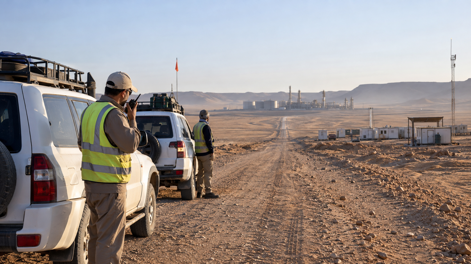
Iraq-wide operations often span very different environments. A national network, energy portfolio, aviation operation, or infrastructure programme may cross cities, industrial areas, remote facilities, transport corridors, and sites managed with partners or contractors. A single flat view can therefore create as much confusion as fragmentation. People need a shared picture, but they do not all need the same level of detail or the same authority.
The response model should define geographic responsibility before an incident. Local teams need sufficient context to manage their area. Regional or functional leaders need to see dependencies and requests that cross local boundaries. National leadership needs a concise view of consequence, priorities, unresolved decisions, and resource pressure. Partners may need selected information without receiving access to unrelated events or personal data.
AtlasNXT Remits can define geographic responsibility and authorised views. This allows an organisation to structure operational visibility around the areas for which teams are responsible rather than distributing every incident to everyone. The design should follow approved governance and information-handling rules. Access should be purposeful, proportionate, and reviewable.
The same discipline applies to external data. Suitable authorised data can be used only where permissions, format, security requirements, and an approved integration or import allow it. The goal is not indiscriminate aggregation. It is controlled use of relevant information for a defined operational purpose.
What should happen when the main communications route is unreliable?
A shared incident picture is most valuable when conditions are difficult, which is also when communications may be degraded. ITU guidance on emergency telecommunications stresses governance, defined roles, information-sharing protocols, coordination structures, and reliable, resilient communications. It also recommends planning for redundant networks and identifying alternatives when a primary channel is unavailable.9
Operational design should therefore begin with realistic communications assumptions. Teams should know the primary route and the planned alternatives appropriate to their environment. They should know who monitors each route, when to switch, how to transfer lead coordination, and how information gathered offline or through voice channels will enter the incident record. These arrangements need testing, not just documentation.
The incident picture must also represent communications uncertainty honestly. A non-response may mean that a person is occupied, outside coverage, using another channel, unable to respond, or in difficulty. It is a prompt for the agreed procedure, not proof of a particular outcome. Likewise, the absence of a new alarm does not necessarily prove that wider operations are normal. Technical telemetry, direct contact, local observation, and contextual information should be considered together.
Resilience is not achieved by promising uninterrupted data. It is achieved by designing a response that can continue when some information is late, partial, or temporarily unavailable, while showing decision-makers exactly where those gaps remain.
How can one model work across telecoms, energy, aviation, and infrastructure?
The sectors are different, but the coordination problem has a recognisable shape.
In telecommunications, specialist systems may show site alarms, network performance, power conditions, and service impact. The shared incident picture adds the status of field teams, access constraints, restoration dependencies, stakeholder decisions, and the ownership of actions that sit outside the network console. This matters particularly when a technical event affects the communications on which other responders depend.
In energy and utilities, process control and supervisory systems remain the authoritative source for plant and network conditions. The shared picture connects that technical state to people, work locations, exclusion areas, contractors, travel, operational priorities, and leadership decisions. Iraq’s energy system has national strategic importance, and its continuing development makes disciplined coordination across assets and organisations increasingly valuable.3
In civil aviation, safety management depends on structured use of safety data and information. The International Civil Aviation Organization describes a proactive approach in which safety risks are addressed systematically and safety intelligence is developed through the collection, processing, analysis, sharing, and exchange of safety information.10 A people-centred incident picture does not replace flight operations, air traffic, airport, or safety-management systems. It gives authorised leaders a place to coordinate the wider organisational response when an issue crosses those functions.
In construction, transport, logistics, and other infrastructure operations, the challenge often lies in movement across a changing geography. The World Bank states that road transport accounts for more than 90 per cent of transport activity in Iraq and notes the importance of strategic corridors to domestic mobility and economic activity.11 When access, weather, road conditions, local disruption, or an incident affects a field team, a useful picture must connect the operational task with the people, vehicles, routes, alternatives, and decisions around it.
No single incident template should erase these differences. The common model is the response logic: establish the scope, assess consequence, identify affected people and operations, define ownership, record decisions, manage actions, review change, and close only when the agreed conditions have been met.
Where does AtlasNXT fit in the response architecture?
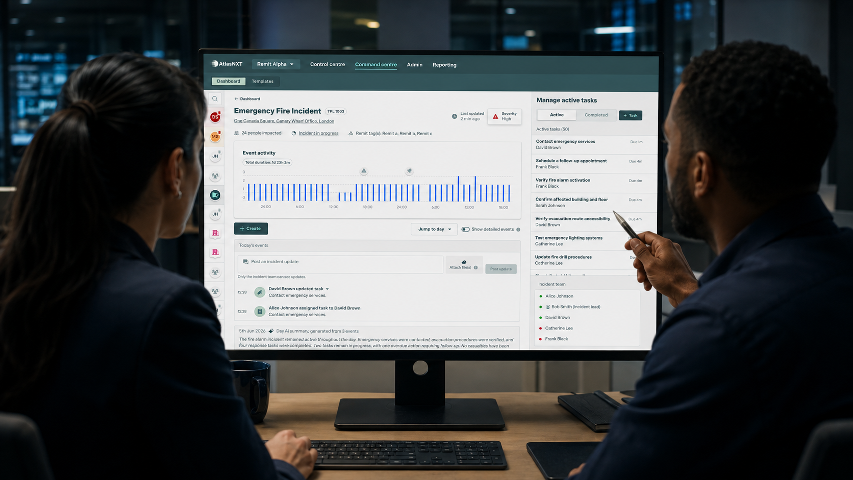
AtlasNXT is designed to provide the people-centred coordination layer around an incident. Its Incident Room keeps significant updates, tasks, communications, decisions, and status changes with one event, helping authorised participants work from the same evolving record. Remits define geographic responsibility and authorised views, so information can be aligned with the teams expected to act on it.
This is not a claim that AtlasNXT replaces a NOC, SOC, SCADA system, aviation system, or other specialist platform. Those systems retain their operational purpose. AtlasNXT provides a place to connect their relevant consequences with field reporting and human response, where suitable authorised data can be handled under the required permissions, format, security conditions, and approved integration or import.
The practical value is accountability. Where these details have been recorded, a leader can see what the organisation has assessed, who has been contacted, what decisions have been made, which tasks remain open, and when the incident will next be reviewed. An operator can add a material update without separating it from the event to which it belongs. A handover can begin from the maintained record rather than from a fresh reconstruction.
AtlasNXT does not remove uncertainty, guarantee communications delivery, or create visibility where no valid information is available. It helps teams manage those realities explicitly within an organised response.
How should an organisation test whether the model is ready?
Readiness should be demonstrated through exercises that involve the people, systems, and communications routes used in practice. The IFRC’s current Emergency Operations Centres guidance links effective coordination with information management, situational awareness, operational readiness, decision-making, and scalable, context-appropriate arrangements.12 ITU guidance similarly recommends exercises and the incorporation of lessons into plans.9
A useful exercise should begin with an ambiguous signal rather than a complete scenario brief. It should force teams to reconcile a technical alarm with field information, identify what remains unverified, decide whether to activate formal incident coordination, and assign ownership. It should introduce a communications problem, a shift change, a competing operational priority, and a request for an executive update. It should test whether partners receive the information they need without being given access to material they do not.
Performance should be judged by operational outcomes. How long did it take to establish an incident lead and a first credible picture? Were conflicting reports exposed or silently blended? Could the team identify every open action and its owner? Did decision-makers know what required their attention? Could an incoming shift explain the current position, significant decisions, outstanding uncertainty, and next review point? Did the final record support a serious review?
The aim is not to make an exercise look smooth. It is to find where responsibility, information flow, access, or communications arrangements break down before a real event places them under pressure.
What should operational leaders do next?
The first step is to map the path from detection to decision. Choose a plausible cross-functional incident and follow it from the first alarm or report through technical assessment, field verification, activation, leadership oversight, handover, and closure. Identify every channel used, every point at which information is retyped, every decision that lacks a formal record, and every action whose owner or deadline could become unclear.
The second step is to define the minimum shared picture. Agree which facts, assessments, decisions, actions, people-status information, geographic context, and review times are necessary for coordinated action. Keep specialist detail in the specialist system unless the wider response genuinely needs it.
The third step is to test the model in conditions that resemble the organisation’s real operating environment. Depending on the operating model, the exercise may include imperfect communications, distributed teams, several jurisdictions, contractor involvement, and pressure for rapid updates. The objective is a response structure that can use information from many sources without confusing volume with understanding.
If your organisation is ready to turn fragmented operational information into a clearer, accountable incident response, book a Complimentary Consultation.
References
1. Republic of Iraq Ministry of Planning, National Development Plan 2024–2028. https://www.mop.gov.iq/documents/economic-policies/development-plans/National%20Development%20Plan%202024-2028.pdf
2. World Bank Group, Iraq: Overview. https://www.worldbank.org/ext/en/country/iraq
3. International Energy Agency, Iraq: Energy System. https://www.iea.org/countries/iraq
4. International Telecommunication Union, Recommendation ITU-T L.1395: Monitoring and control interface for power, cooling and building environment systems in telecommunication networks. https://www.itu.int/epublications/publication/itu-t-l-1395-2025-07-monitoring-and-control-interface-for-power-cooling-and-building-environment-systems-in-telecommunication-networks-generic-interfa
5. Joint Emergency Services Interoperability Principles, Common Operating Picture. https://www.jesip.org.uk/joint-doctrine/common-operating-picture/
6. International Organization for Standardization, ISO 22320:2018, Security and resilience, Emergency management, Guidelines for incident management. https://www.iso.org/standard/67851.html
7. UK Cabinet Office, The Amber Book: Managing Crisis in Central Government. https://www.gov.uk/government/publications/the-central-government-s-concept-of-operations/the-amber-book-managing-crisis-in-central-government-html
8. UK Health Security Agency, Incident Response Plan. https://www.gov.uk/government/publications/emergency-preparedness-resilience-and-response-concept-of-operations/incident-response-plan
9. International Telecommunication Union, Guidelines for National Emergency Telecommunication Plans. https://www.itu.int/en/ITU-D/Emergency-Telecommunications/Documents/2019/NETP_Global_guideline.pdf
10. International Civil Aviation Organization, Safety Management. https://www.icao.int/safety-management
11. World Bank Group, New Financing to Improve Iraq’s Road Connectivity and Support Job Creation. https://www.worldbank.org/en/news/press-release/2026/06/05/new-us-900-million-world-bank-financing-to-improve-iraq-s-road-connectivity-and-support-job-creation
12. International Federation of Red Cross and Red Crescent Societies, Emergency Operations Centres Guide 2026. https://www.ifrc.org/document/ifrc-emergency-operations-centres-guide-2026